Point-Mapping Extension
This Point-Mapping Extension (MapPoint) combines a referenced image / map and point-coordinates. The result is a geo-referenced map with a geo-referenced point.
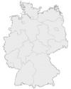
Über eine Extension können Punktkoordinaten mit georeferenzierten Karten verbunden werden. Diese Möglichkeit wird mit der Point-Mapping_Extension gezeigt. Eine zuvor hochgeladene Deutschlandkarte, wie sie in vielen Artikeln zur Veranschaulichung von Ortschaften genutzt wird, wird mittels einer MediaWiki-Extension georeferenziert. Zusammen mit den ebenfalls an die Extension übergebenen Punktkoordinaten wird eine Karte generiert, in der die Lage des Punktes angezeigt wird.
Inhaltsverzeichnis
Features
- Georeferenzierung einer Karte
- Darstellung eines Lagepunktes mittels geographischer Koordinaten
- Darstellung beliebig vieler Punkte
- Verknüpfung des Punktes mit einem beliebigen Link
- Hinweisfenster beim Überfahren des Punktes mit der Maus
Installation
Parameter
- [] - ist bezogen auf das eigentlich angezeigte Bild
 * $varURLMap: URL der Karte/Image-URL (z.B.: "http://www.giswiki.org/images/c/c1/DeutschlandRef.png";)
 * $varURLPoint: URL des Punktsymbols / Symbolimage-URL(z.B.: "http://www.giswiki.org/images/1/1b/Reddot.gif";)
 * $varMapWidth: = gewünschte Kartenbreite / desired width of the map
 * $PointExt: Punktsymbolgröße / desired symbol-size
 * $A: Meters/Pixel in horizontaler x östlicher Richtung / meters/pixel in horizontal x Easting direction
 * $E: Meters/Pixel in verticaler y nördlicher Richtung / meters/pixel in vertical y Northing direction
 * $C: x Easting UTM coordinate of center of upper left pixel in meters
 * $F: y Northing UTM coordinate of center of upper left pixel in meters
- {}- ist bezogen auf Punktkoordinaten (davon können Sie soviel setzen wie Sie wollen)
 * $varPointLon: Punktkoordinate (Geographische Länge) / point coordinates - Longitude
 * $varPointLat: Punktkoordinate (Geographische Breite) / point coordinates - Latitude
 * $varHRef: Link (optional)
 * $varTitle (=$varAlz): Für Hinweise (Mousover) und das <alt> tag (optional) / for hints and the <alt> tag
See Samples for input of parameters.
Links
Bugs
- a png-Image did not get displayed in IE-Explorer (http://www.giswiki.org/images/b/b0/DeutschlandGeoref.png)
It works when using http://www.giswiki.org/images/e/e1/DeutschlandRef.jpg
To Do's
-
Übergabe mehrere Punkte - Kombination mit einer Vorlage (??)
-
Parameterübergabe in mehreren Zeilen -
Punkte mit URL verbinden - Externes URLSymbol (
 ) per CSS verschwinden lassen
 -
Hinweistext und Alternativtext für Punkte - Punkte überlagern sich und Informationen werden nicht dargestellt.
Hinzufügen neuer Punkte
Hier finden sie weitere Informationen zur Verwendung der Point-Mapping Extension Für die Anlage neuer Karten lesen sie bitte den dortigen Text.
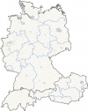
Das unten anfgefügte Beispiel zeigt fett markiert einen neuen Punkt der in der Karte DE-CH-AT_ref.jpg dargestellt werden soll. Neue Punkte werden in geschweiften Klammern eingeschlossen {...}.
Als Angaben sind:
- die Geographische Länge und die
- Geographische Breite erforderlich. Beide in dezimalen Gradangaben !
- Ein Link sowie
- ein beschreibener Text kann optional hinzugefügt werden.
Beispiel
<MapPoints>
[
http://www.giswiki.org/images/2/29/DE-CH-AT_ref.jpg
http://www.giswiki.org/images/9/92/Bluedot.gif
10
200
0.014105171975
-0.008989824183
5.809850000000
54.997352777778
]
{
11.5750
48.1400
http://de.wikipedia.org/wiki/München
München
}
{
11.6167
52.1333
http://www.geolock.de
GEOLOCK GmbH
}
</MapPoints>
Wie ermittele ich die Koordinaten eines Ortes etc. ...?
- Mittels des Tools hjl_get_CoorM lassen sich die Koordinaten aus den Google Maps ermitteln. Für den deutschsprachigen Bereich sind allerdings nur Satelittenbilder verfügbar.
- Die deutschsprachige Wikipedia hat zu vielen Ortschaften Koordinatenangaben gemacht. Sollten die Koordinaten nicht in dezimalen Gradangaben vorliegen dann folgen sie dem Link (
 , falls vorhanden), der mit diesen Koordinaten verbunden ist. Das neue Fenster zeigt eine Liste von Kartendiensten, die diese Koordinaten anzeigen. Map24 beispielsweise zeigt dann auch die geographischen Koordinaten.
- Koordinaten können auch von OpenGeoDB bezogen werden. Einfach auf http://opengeodb.de/suche/ den entsprechenden Ortsnamen eingeben und die dort angezeigten Koordinaten verwenden.
Mein Punkt erscheint nicht - Punkte überlagern sich!
Dies ist ein noch vorhandenes Problem. Es wird an einer Lösung gearbeitet.
Samples
Karte
Beachten sie die Hinweise zum Hinzufügen neuer Punkte in eine Karte.
<MapPoints> [ http://de.giswiki.net/images/2/29/DE-CH-AT_ref.jpg http://de.giswiki.net/images/9/92/Bluedot.gif 10 600 0.014105171975 -0.008989824183 5.809850000000 54.997352777778 ]
{ 8.778323 51.729128 http://www.mettenmeier.de Mettenmeier GmbH } { 16.663 49.207904 http://de.giswiki.net/wiki/BERIT ASSECO Central Europe a.s. (Czech Republic) } { 7.705472 47.531169 http://de.giswiki.net/wiki/BERIT BERIT AG (Schweiz) } { 8.510925 49.4426 http://de.giswiki.net/wiki/BERIT BERIT GmbH (Deutschland) } { 8.68333 50.1167 http://www.geoas.de AGIS GmbH } { 6.641389 49.756667 http://www.alta4.com alta4 Geoinformatik AG } { 6.1056523 50.773573 http://www.ahu.de/ ahu AG - Wasser · Boden · Geomatik } { 7.182492 50.7803347 http://www.supportgis.de CPA Geo-Information } { 7.6538 51.9330 http://www.conterra.de con terra GmbH } { 11.5167 47.9762298 http://www.das-byro.de das byro Marchfeld } { 8.42742 49.01316 http://www.ddsgeo.de DDS Digital Data Services GmbH } { 9.53333 48.7167 http://www.digiterra.de/ DIGITERRA } { 6.358333 50.922222 http://www.geospatial-services.de/ Dr. Neumann Consulting - Geospatial Services } { 9.4429244 51.325717 http://www.inovagis.com iNovaGIS oHG Kassel } { 9.76057 52.3983 http://www.gdf-hannover.de/ GDF Hannover } { 9.71667 52.3667 http://www.entera.de/ entera } { 8.533 47.195 http://www.geozug.ch Gätzi Vescoli AG Baar } { 14.812787 50.890085 http://www.idu.de IDU mbH in Zittau } { 11.616700 52.133300 http://www.geolock.de GEOLOCK GmbH Magdeburg } { 11.342500 48.095770 http://www.wigeogis.de WIGeoGIS GmbH München } { 7.364477 51.304004 http://www.wigeogis.de WIGeoGIS GmbH Dortmund } { 13.022395 47.491763 http://www.wigeogis.at WIGeoGIS GmbH Salzburg } { 13.73688 51.02941 http://www.virtualcitysystems.de virtualcitySYSTEMS GmbH } { 16.231593 48.122702 http://www.wigeogis.at WIGeoGIS GmbH Wien } { 8.392546 50.255995 http://www.punchbyte.de Punchbyte Software } { 8.383135 49.485434 http://www.geoventis.de Geoventis GmbH Darmstadt } { 13.317477 52.664135 http://www.lambdamedia.de Lambda Media } { 8.252003 50.359985 http://www.geoventis.de Geoventis GmbH Asslar } { 9.6055 52.31548 http://www.contelos.de Contelos GmbH } { 7.23 53.59 http://www.norbit.de norBIT GmbH } { 9.81561 52.32038 http://www.raumbezug.eu raumbezug GbR } { 8.7014 49.298 http://www.mysynergis.com SYNERGIS Informationssysteme GmbH } { 16.3667 48.2000 http://www.mysynergis.com SYNERGIS Informationssysteme GmbH } { 11.4000 47.2667 http://www.mysynergis.com SYNERGIS CAD-Info-Systeme GmbH } { 13.0389818 47.823781 http://www.spatial-services.com/ Spatial Services GmbH - Geoinformatiklösungen und Dienste - GIS Consulting } { 9.187839 48.805271 http://www.fit.fichtner.de.de Fichtner IT Consulting } { 7.645011 51.961904 http://www.eftas.com EFTAS Fernerkundung Technologietransfer GmbH } { 9.504933 47.01274 http://www.sourcepole.ch Sourcepole AG } { 12.395206 51.333742 http://www.aphos.de aphos Leipzig AG } { 8.1976891 53.151506 http://omniscale.de Omniscale } { 13.428701 52.489472 http://www.geosysnet.de geoSYS } { 12.395250 51.333740 http://www.gis-mapping.de GIS-Mapping.de } { 9.8665 54.1662 http://www.torr.de torresin & partner } { 11.3278 48.1056 http://www.eagle-eye-earth.com Eagle Eye Earth } { 16.2500 47.8167 http://www.mobilegis.at mobileGIS.at } { 12.11553 54.07479 http://www.gdi-service.de GDI-Service Rostock }
</MapPoints>
Munich and Berlin
<MapPoints>
[
http://de.giswiki.net/images/2/29/DE-CH-AT_ref.jpg
http://de.giswiki.net/images/9/92/Bluedot.gif
10
200
0.014105171975
-0.008989824183
5.809850000000
54.997352777778
]
{
11.5750
48.1400
http://de.wikipedia.org/wiki/München
München
}
{
13.394444
52.516667
http://de.wikipedia.org/wiki/Berlin
Unsere allerliebste Hauptstadt
}
</MapPoints>
<MapPoints> [ http://de.giswiki.net/images/2/29/DE-CH-AT_ref.jpg http://de.giswiki.net/images/9/92/Bluedot.gif 10 200 0.014105171975 -0.008989824183 5.809850000000 54.997352777778 ] { 11.5750 48.1400 http://de.wikipedia.org/wiki/München München } { 13.394444 52.516667 http://de.wikipedia.org/wiki/Berlin Unsere allerliebste Hauptstadt } </MapPoints>
Code
<?php
# MapPoints by Heinz-Josef Lücking h-j.luecking@t-online.de
#
# Copy this text into a file called "MapPoints.php" and save it into the directory "extensions"
# To activate the extension, include it from your LocalSettings.php
# with: include("extensions/MapPoints.php");
# Hint: Do'nt mix up MapPoints with the older version MapPoint!
#
#
# Licence: "Creative Commons", explicit http://creativecommons.org/licenses/by-sa/2.0/de/deed.en
#
# visit http://www.giswiki.org
#
# Have fun
#
$wgExtensionFunctions[] = "wfMapPoints";

function wfMapPoints() {
  global $wgParser;
  $wgParser->setHook( "MapPoints", "renderMapPoints" );
}

function renderMapPoints( $input ) {

  #----------------------------------------#
	# Splits input into basic map and points #
  #----------------------------------------#
  $s = $input;
	$s = str_replace("\n\r","|",$s);
	$s = str_replace("\n","|",$s);
	$s = str_replace("\r","|",$s);
	$s = str_replace("[|","[",$s);
	$s = str_replace("|]","]",$s);
	$s = str_replace("{|","{",$s);
	$s = str_replace("|}","}",$s);
	$s = str_replace("]|{","]{",$s);
	$s = str_replace("}|","}",$s);

  preg_match_all('/([\[\]{}])(.*?)([\[\]{}])/', $s, $matches, PREG_SET_ORDER);
  # explode
  foreach($matches as $match) {
    $varAr[] = explode('|', $match[2]);
  }

  #------
  # MAP #
  #------

  # Image(Map) and Point-file

  $varURLMap   = $varAr[0][0];
  $varURLPoint = $varAr[0][1];
  $PointExt    = $varAr[0][2]; # PointSize (width = height)

  # Getting some image-information

  $varMapWidth  = $varAr[0][3];              # the width the image should be displayed
  $size         = getimagesize("$varURLMap");# the real size of the image
  $height       = $size[1];                  # real height
  $width        = $size[0];                  # real width
  $varZoom      = $varMapWidth / $width;     # zoom-factor
  $varMapHeigth = $height * $varZoom;        # computed image-heigth

  # Georeferencing the image (see http://en.wikipedia.org/wiki/World_file)

  $A = $varAr[0][4];
  $E = $varAr[0][5];
  $C = $varAr[0][6];
  $F = $varAr[0][7];

  #---------
  # POINTS #
  #---------

  foreach($varAr as $k=>$v) {
    if($k>0) {
      $varPointLon = $v[0];
      $varPointLat = $v[1];

      # Calculating the position of the point on the image

      $xImg = ((($varPointLon - $C) / $A) * $varZoom) - ($PointExt / 2);
      $yImg = ((($varPointLat - $F) / $E) * $varZoom) - ($PointExt / 2);

      # Adding an additional Link to the point;
      if ($v[2] == "")  {$varHRef = "";} else {$varHRef = " href=\"".$v[2]."\"";  }

      # for Hints (Mousover) and the <alt> tag
      if ($v[3] == "") {$varTitle = ""; $varAlt = "";} else {$varTitle = " title=\"".$v[3]."\""; $varAlt = " alt=\"".$v[3]."\"";  }

      # add some random text to <div id="myMapPoints...
      $MapRand = rand();

      $aPoint .= "<div id=\"myMapPoints".$MapRand."\" class=\"\" style=\"position: relative; left: 0px; top: 0px; width: 0px; height: 0px; visibility: visible;\"> <a ".$varHRef." ".$varTitle."><img name=\"myMapPoints_\" style=\"opacity: 1.0; position: absolute; top: ".$yImg."px; left: ".$xImg."px;\" src=\"".$varURLPoint."\" height=\"".$PointExt."\" width=\"".$PointExt."\" ".$varAlt." ></a></div>";
    }
  }


  #---------------------#
  # Building the output #
  #---------------------#

  $MapRand = rand(); # add some random text to <div id="MapPoints...
  $output = "<div id=\"MapPoints".$MapRand."\" class=\"MapPoints\" style=\"position: relative; left: 0px; top: 0px; width: ".$varMapWidth."px; height: ".$varMapHeigth."px; visibility: visible; background-color: white;\"> <img name=\"myMap\" style=\"position: absolute; top: 0pt; left: 0pt;\" src=\"".$varURLMap."\" height=\"".$varMapHeigth."\" width=\"".$varMapWidth."\"> ".$aPoint."</div>";

  return $output;
}
?>
Siehe auch
Einsatz der Extension
- http://wiki.wagendorf.de/index.php/Karte
- http://www.gothopedia.de/
- http://schulhundweb.de/wiki/index.php/%C3%9Cbersichtskarte
Lizenz
"Creative Commons", und zwar explizit die Namensnennung-Weitergabe unter gleichen Bedingungen 2.0 Deutschland http://images.giswiki.net/f/f1/CreativeCommond_logo_trademark.gif
Whithin GISWiki you can share georeferenced Images. See Shared Images with world file data for a list of available Maps.
Following Images/Maps are available:

